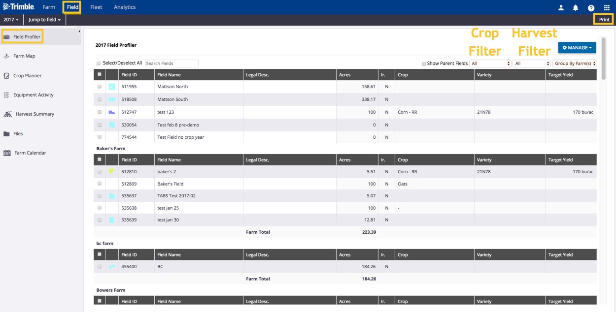
Draw boundaries with Field Profiler
In addition to managing fields and boundary data, use the Field Profiler™ to preview, draw, delete and change boundary colours in Trimble Ag Software. Web drawing tools allow you to zoom in to your farm location on satellite maps to create point-and-click shape files. Easily edit, redraw and add inner boundaries, while the software auto-calculates the size of drawn boundaries for your fields.
- Log in to your account online (learn more)
- Select the preferred crop year (top left)
- Click on the Field tab (top menu)
- Select Field Profiler
- View the list of fields for the specified crop year, with options to search, filter or print the views selected
- Hover your cursor over the field boundary thumbnail image (if shown)
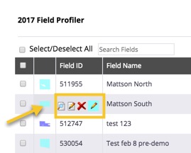
- Click on the new icons visible for a field (if applicable) to:
 Preview Boundary:
- View and zoom in/out over a 2D map pop-up of your field boundary
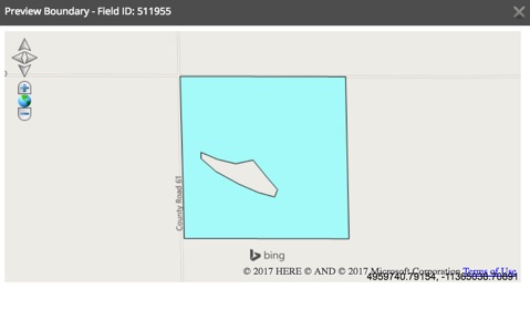
- Click the X to close the preview window
- View and zoom in/out over a 2D map pop-up of your field boundary
 Draw Boundary:
- Zoom in/out on the map editor pop-up to locate your field
- Click Draw Boundary
- Click to drop points on the map to create a boundary
- Double-click on the last point to finish drawing the boundary
- Click Save Boundary
- Preview the boundary shape and area size, or use drawing tools at the top of the map to Edit Boundary, Draw Inner Boundary, Redraw Boundary, or use Measurement Tools (line or polygon) to draw landmarks such as fences or ponds and calculate distance and area
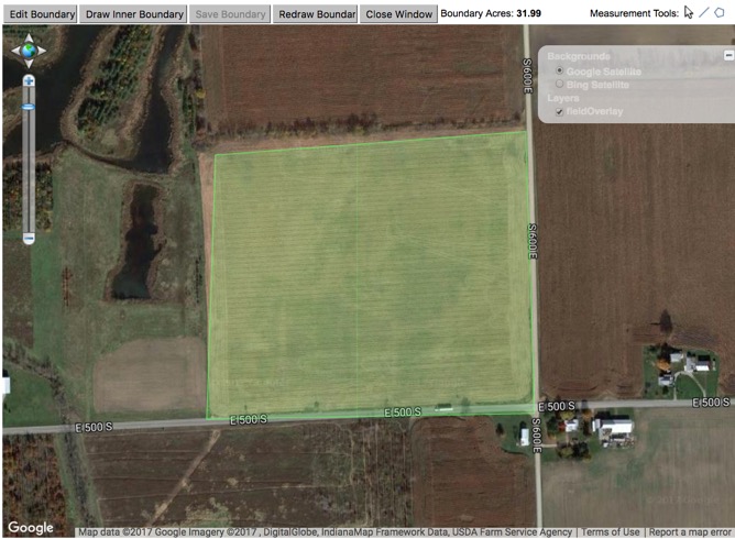
- Click Close Window
 Delete Boundary:
- Click OK to confirm at warning to remove boundary (or Cancel)
- Boundaries deleted from the Field Profiler will still be visible under the Farm menu, where they can also be retired from view.
 Change Color of boundaries:
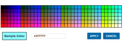
- Click on a color in the palette grid to view the sample color, or enter an alpha-numeric Hex color code
- Click Apply (or Cancel)
- Tip: To update boundary colors on multiple fields at once:
- Click the check boxes to select one or more fields
- Click on the Manage button
- Select Update Boundary Color
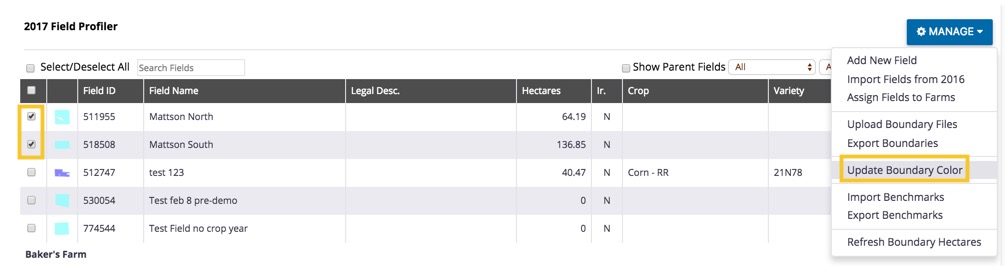
- Use the palette grid (as shown above) to select or enter a color code
- Click Apply (or Cancel)
- Tip: To update boundary colors on multiple fields at once: