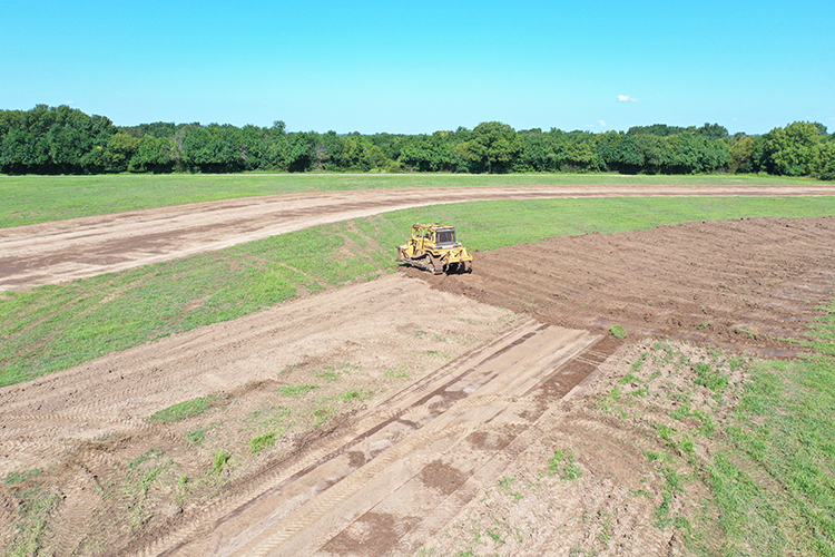
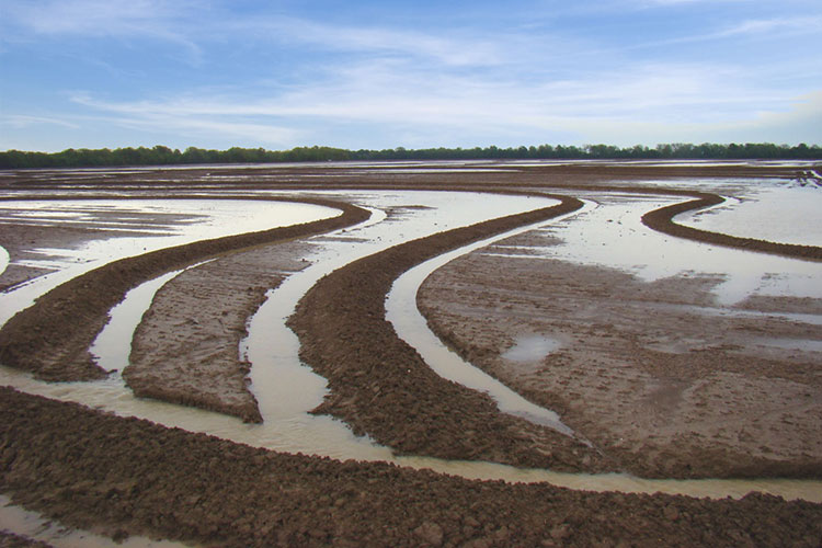
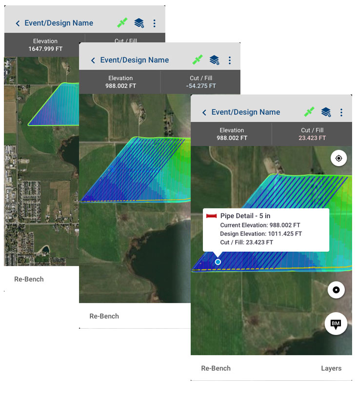
WM-Survey II App

The WM-Survey II app is the only tool you need to get started with water management activities on the farm. This free-to-download mobile application makes it easy to create basic field surveys for use in water management activities, and automates the creation of terrace and waterway cross-section profile designs as well as auto-creates rice levee designs.

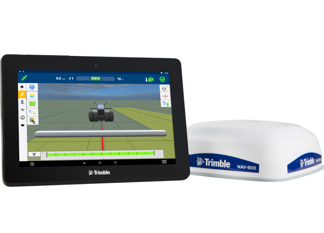
Compatible with any Android phone or tablet (version 10.0 or higher, and we strongly recommend a tablet with a 1.8 GHz 64-bit processor and 6GB RAM), as well as the GFX-750™ display, users can connect any GNSS receiver they own to their device to create topographic maps for use in a variety of surface and subsurface applications.

Download The App Brochure

Key Benefits

  • Automated terrace and waterway cross-section profile designs
  • Automated rice levee designs allow same day installation
  • Get to work installing designs minutes after completing field surveys
  • Intuitive workflows guide users and reduce errors
  • Save time with quick and easy verification of surface or tiling designs
  • Save money by using the survey equipment you already own
  • Easily accessible entry-level application for beginning water management work

Auto-Design Subscriptions

Enabled through an optional subscription, WM-Survey II becomes even more powerful by automating the creation of certain surface drainage structures.

Typically reserved for our water management design software packages, this advanced feature set can generate terrace cross-section profile designs, waterway cross-section profile designs, rice levee system designs, as well as the 3D surface control files and navigational guidance lines needed by earthmoving equipment to implement the designs.

Terrace & Waterway Solution Subscription

Terraces and waterways are designed to divert water off a field such that soil erosion and crop loss due to water ponding is reduced. Terraces have a high side that prevents water from running over the top of it, while also typically sloping to the side to divert water into a waterway or ditch outlet along the edge of a field. Waterways transport water off a field to a designated outlet.

The Terrace & Waterway Design solution allows the user to easily and automatically create a basic terrace or waterway design in just five steps. The 3D control files and feature line guidance files for compatible Trimble displays are also auto-created, allowing land forming work to begin right away – no more waiting for designs to come back from the office. Farmers can now conduct their own maintenance, saving money on contractors by extending the life expectancy of terraces and waterways while preventing up to 5% yield loss in terraced fields.

Rice Levee Design Subscription

Rice is grown in a consistent depth of water to help limit weeds, reduce insect infestations and boost overall crop health. Because fields have a minimum slope to one corner for drainage, rice levees are used to hold water at a constant depth across the elevation gradient of the field. As the water reaches the outlet of the field it is then pumped back to the top to restart the process.

The Levee Design subscription feature uses a four-step guided workflow to auto-create rice levees based on desired specifications and elevation across a field. Upon creation of the design, feature line guidance files are also exported and available for use in levee installation. Minimize yield loss from weather-delayed planting by getting to work implementing the designs right away. Eliminate the hours or days waiting for a designer to get back to you.

WM-Survey II Compatibility

SubscriptionDescriptionGFX-750Android v10+ Device
Core App (free)Create and display a topographic survey of the layout of your field
Import design file and verify a water management project
Terrace & Waterway SolutionAuto-create terrace cross-section profile design based on elevation (.txt and .xml file export included)
Auto-create waterway cross-section profile design based on line placement (.txt and .xml file export included)
Create 3D surface control files (.gps file export included)
Create guidance layer in WM-Survey II app and/or guidance layer to display system (.shp file export included)
Rice Levee SolutionAuto create levee design based on elevation (.txt and .xml file export included)
Create guidance layer in WM-Survey II app and/or guidance layer to display system (.shp file export included)

Why Conduct a Survey?

A survey creates an elevation map of a field that is the first step in any water management decision making. It provides a general lay of the land, allows measurement of different areas, and helps determine what solutions may be applied.

When paired with a sufficiently accurate GNSS receiver, WM-Survey II allows the easy recording of elevation points across a field to generate a topographic map*. This topographic map, or survey, can be exported to other software programs and then used to create land forming and grading designs as well as surface and sub-surface drainage designs.

Topographic data can be analyzed to determine:

  • Water flow direction into and out of survey region
  • Most efficient water removal route
  • Most efficient water retention location
  • Ideal terrace location
  • Ideal waterway location
  • Ideal location for gates or pumps with drainage tile projects
  • Ideal location and size of watersheds for compliance
  • Best starter hole locations for drainage installation
*RTK correction is the preferred method for surveys to ensure a high-accuracy topographic map

Project Verification

WM-Survey II makes verification at the end of a water management project fast and easy. Simply import the design file that was used and then walk or drive across the surface of the field to compare the designed elevation to the actual work that was performed. If any problem areas are identified, simply drop a pin to revisit at a later date.

WM-Survey II Devices and Supported Receivers

PlatformReceiverHigh-precision surveysLow-precision surveys
GFX-750 display +WM-Survey IINAV-900 guidance controller
NAV-500™ guidance controller
Mobile Android device+ WM-Survey IISPS986 smart antenna*
SPS985 smart antenna
AG-342 GNSS receiver
AgGPS 542 GNSSreceiver
Catalyst
3rd party receiversVariesVaries
*To get RTK correction on the SPS986, one of the following is required: 1) Local base station broadcasting 450 Mhz or 900 Mhz corrections; or 2) VRS/NTRIP corrections and an internet connection

Related Products

Let’s Get Started

Embrace the power of proven precision agriculture technologies from Trimble to enhance your planting and seeding operations, while increasing your productivity and profitability by saving on wasted inputs.

Where To Buy